www.ordnancesurvey.co.uk/osmaps/route/5581769/wayfarers-watership-down
We started this walk at White Hill car park. Don’t be fooled by all the cars parked along the road, there is a car park hidden on the east side of the road.
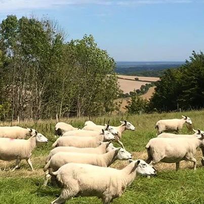
Navigating the first part of the walk was very simple, the path across Watership Down is wide and obvious. Less straight-forward was finding the plaque celebrating Richard Adams whose 1972 novel ‘Watership Down’ about the adventures of a group of rabbits is set here. We did eventually find it – basically look out for a tree with a fence around it on your left, and it’s attached to that.


Looking back towards the car park you can see the tall radio mast. We’d spotted this on our last walk too and wondered what it was. It is the Hannington Transmitting Station which broadcasts television and radio to Berkshire and north Hampshire. If you like facts and figures, it is 151.9 metres (498 ft) tall – big enough to reassure us we shouldn’t be able to get lost, as we could always head for that to find our cars again!
It didn’t take long for us to find the point where we had left the Wayfarer’s Walk last time. We could see Ladle Hill, Beacon Hill and Sidown Hill and reminisced about our last adventure!
We turned south and not too much further we stopped to have our lunch. We sat at the edge of a field which had a steep dip in the middle of it and we were treated to an aeronautical display by several large red kites as we munched our sandwiches.
When we reached the road we turned right to Hare Warren Farm – and made use of Hare Warren Copse for toilet facilities (these things are important!) – before heading up the hill to find the Portway Roman Road on the other side.
The Portway used to run between Calleva Atrebatum (Silchester) and Sorviodunum (Salisbury). It looks very straight on the map, and it is, but that doesn’t mean to say it is flat – we found it undulated more than enough for a very warm day!
The bit along the road, was a bit busy with traffic, but it isn’t too long before you get onto a smaller quiet road.
The road meets the Wayfarer’s Walk again at Walkeridge Farm. Unlikely as it may seem this farm has an airfield. We saw no sign of it, but apparently in the 1970s there were ten aircraft listed as being based here. It is also a caravan site.
We turned left and followed the path back to the car park, stopping for a tea break before making our way down towards the car.

This circuit was about 8 miles.
