This wasn’t a walk we’d have thought to do if we hadn’t commited to walking the full Wayfarers Walk, but it’s interesting to explore new areas!
The first bit of the walk takes in an industrial estate. Apparently, during the prehistoric period, the area of marsh to the west of the Brockhampton stream, was an area of raised shingle beaches. Bronze Age pottery has been found and a number of small hearths and finds dating to the Iron Age suggest that this was a salt production site during that period. Now concrete production was the most notable industry! We took this photo looking the other way!!

Crossing the A27 we were unable to find the footpath on the map, so had to walk through the industrial estate, but picked the path up again where it crossed the fields. The path then goes along the railway to an impressive 21-arched double-curve viaduct with a long, gentle gradient. The bridge was built to restore access between the Bedhampton and the mill and Langstone Harbour when the railway was built.
We walked past the Old Granary, built in 1868. It was part of an industrial complex comprising a watermill, a ship’s biscuit factory in the field opposit and a system of railway sidings and turntables to deliver grain to the mill and bisuits to the Naval Dockyard in Portsmouth. We then crossed to Bidbury Mead – once a hay meadow for the manor, but now a recreation ground. Look out for the opportunity of a toilet stop and a loud parrot who lives in a garden adjacent to the path through the park!
The next bit of the walk is a bit dull – a long straight road. After crossing the motorway you pass the site of the Admiralty Telegraph Station which was built at Camp Down in 1821 and it operated on a semaphore line from London to Portsmouth unitl 1847, but we didn’t notice anything. Farlington Redoubt was built to protect the eastern flank of Fort Purbrook. It was a smaller version of the fort proper, but it was demolished in before the 1970s, and we didn’t notice the a hole in the chalk that marks the spot of that either.
At the top of the hill we reached fort Purbrook and we did notice that!
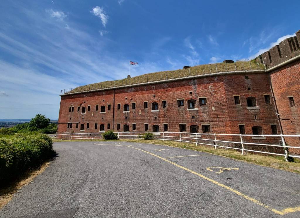
Fort Purbrook was completed in 1870 and forms part of the line of forts on Portsdown Hill (along with Fort Widley which we came across on our last walk). During the first world war, Fort Purbrook was armed with anti-aircraft guns and thereafter was used as a siege artillery barracks. The army left the site in 1925, but in the second world war it became an ambulance base, a barracks and a centre for civil defence (including responsibility for preparing for possible nuclear attack). Now it is an activity centre.
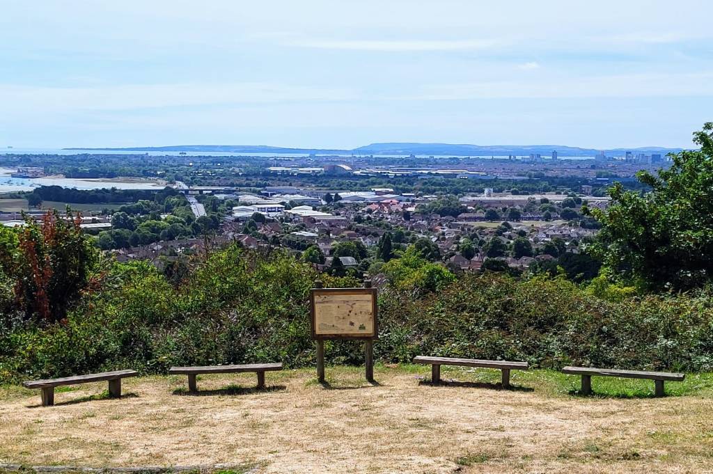
We stopped for our lunch with a view a little further on. We were disappointed that there was no ice cream van at this car park, so when we headed down into Drayton we stopped at Heath’s cafe for a cuppa, a generous bowl of ice cream and to use their facilities.
We then walked through the residential area and out of town along the A-road to Farlington Marshes. The tide was out so it wasn’t looking it’s best, but this was the most interesting bit of the walk.

Virtually all of Farlington Marshes lies below sea level. The land was reclaimed in 1771 and the sea wall we walked along protects the marsh from the sea. Since 1961 the marshes have been a nature reserve, but prior to that they had a very interesting history.
In 1891 a racecourse, called ‘Portsmouth Park’, was built on the northern part of Farlington Marshes. There was a large grand stand and the railway company ran special trains from London and Brighton although the success was debatable, with the location described as dreary and isolated. The race course was still in business in 1915 when the War Office commandeered the land and used it as a site to dump ammunition. The railway station was initially retained to serve the ammunition dump but closed in 1917. At the end of the war it was one of the biggest ammunition dumps in the country – in 1922 they disposed of 3,000 tons of ammunition a week for about 8 months, with the loud noise causing disturbance to the local residents.
World War Two also saw Farlington Marshes playing an important role. A secret department was formed at Britain’s Air Ministry to co-ordinate a strategy to deceive German bombers. To reduce the impact of the bombing, an ingenious system called ‘Starfish sites’ was devised to fool enemy aircrews into dropping their bombs where they could do relatively little damage. To protect nearby Portsmouth, a series of fires would be lit across Farlington Marshes, parts of Hayling Island and on the small islands in Langstone Harbour to give the impression of a city under attack. Other structures were lit which looked like light was coming from chinks in blackout curtains that were supposed to keep the city dark. The decoy had some success and on the nights of 17th and 18th April 1941, 200 bombs that were intended for Portsmouth were dropped in this decoy area instead. The Farlington Control No1 building complete with rusty box which was once the observation hatch is still visible at the start of the sea wall path.
As we walked round the sea wall, we saw something which I have always hoped to witness – murmurating starlings. It wasn’t a huge flock, but impressive to watch nevertheless.
At the most south-easterly point of the sea wall, we watched out for a strange mound on the mudflats. This was the site of the ‘oyster house’, which was used to guard the oyster beds in the harbour. It was built from bricks, covered with tar to waterproof them so it was also know as the ‘black house’. At one time the oyster industry was very important in this area and from this vantage point, all the oyser beds along the north western corner of Hayling Island could be observed. However, after the deaths of several people (including the Dean of Winchester in 1902), the oyster trade from Langstone harbour ceased to be viable due to pollution.
As we walked back towards the mainland, there were several low islands visible in the mudflats. North Binness Island is the largest, but it only rises 2.5 metres above sea level. There is archaeological evidence that suggests the island was occupied during the Bronze Age and the Roman period, including evidence of a salt works.
The path then goes alongside the main road and follows the coastline back round to where we’d left our cars.
This loop was about 8.5 miles.
