We started this walk at the National Trust car park and cafe we visited on our previous Greensands Way walk and started with a coffee at the view point to fuel our walk.
The landscape is stunning with the hillside dropping away to a steep circular valley. Legend has it that the devil lived at the devil’s jumps – three small hills near Churt. It was thought that Thor, the god of thunder lived near here in Thursley (Thor’s Lea) and the devil enjoyed tormenting Thor by jumping from hill to hill. Thor would retaliate by trying to strike the devil with thunder and lightening. On one occasion, Thor is said to have been so enraged that he scooped up a handful of earth and hurled it at the devil, leaving the depression which remains. A more scientific, but less fun explanation, is that it was created by a process called spring-sapping. Rainwater percolates through the permeable Lower Greensand rocks, but when it meets the underlying impermeable Atherfield Clay, it has to travel horizontally, emerging on the hillside where the sandstone and clay meet and eroding the rock to make a hollow. Either way, when the mist sits in the Punchbowl it does look very eerie and mysterious.
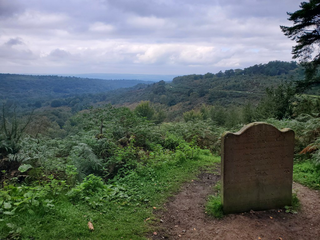
We turned east and walked around the top of the Punchbowl and it didn’t take us long to find more disturbing landmarks. There is a memorial stone marking the scene of the murder of an unknown sailor on 24 September 1786. He was travelling to his ship in Portsmouth when he met three men in the Red Lion pub at Thursley. He bought them drinks, but they then followed him and murdered him in the Devil’s Punchbowl. They were quickly apprehended at the Sun Inn in Rake, tried and executed, and their bodies hung on Gibbet Hill. Dickens references the incident in his novel Nicholas Nickleby with sinister poetry describing that the blood of the murdered man had run down, drop by drop, into the hollow…The devil’s bowl… had never held fitter liquor than that!
We took a little detour to the top of Gibbet Hill which has spectacular views both north and south. The area was once notorious for highway men and robbers. Criminals were hanged on the gibbet and their tarred bodies left to swing in clanking irons in this prominent location until they rotted as a warning and a deterrent. The area had a reputation for being haunted so, in 1851, Sir William Erle a local judge had a granite Celtic cross erected near the site to try to dispel the fears of local residents.
More recent history is also tragic. On 6 May 1945, an United States Army Air Force plane (a Curtiss-Wright C-46 Commando) was flying over Gibbet Hill in bad weather. The aircraft struck a radar tower and crashed. All 30 passengers and crew died along with one person on the ground.
Not everything about this area’s past is so grim. Historically broom-squires, who made besom brooms lived here. Their brooms were used in both Windsor Castle and Hampton Court.
We had a sunny day for our walk with the colours just beginning to change on the trees. As we made our way around the perimeter of the Punchbowl, we were treated to the sight of proper fairytale, red and white, Fly Agaric toadstools. We thought the first group we saw was a special sighting, but the more we looked, the more we saw and they pretty much lined this part of the path! Throughout our walk we saw many beautiful fungi.


Our path took us over the top of the A3, not that we would have known it, as it now in a tunnel under the hillside! The Hindhead tunnel is 1.2 miles long and opened in 2011. Prior to its construction, the route climbed around the rim of the Devil’s Punch Bowl and through Hindhead. It was the only section of the A3 which was not a dual carriageway road, causing substantial delays and environmental impacts. The former road has been restored to nature, reconnecting the Devil’s Punchbowl and Hindhead Common.
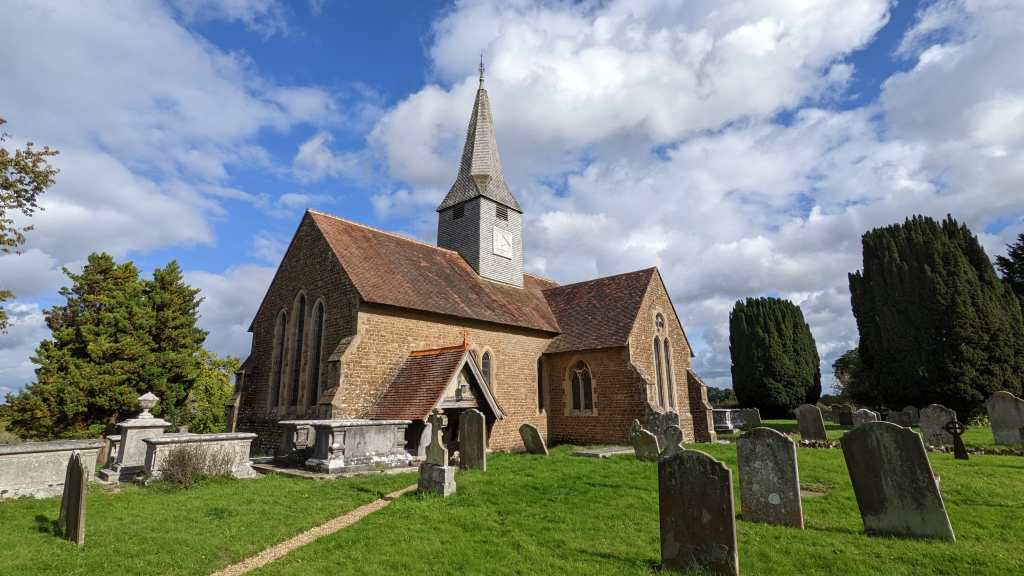
We followed the Greensands Way through farmland to Thursley and through the churchyard of St Michael and All Angels, which dates back to Anglo-Saxon times. Somewhere in the churchyard there is the gravestone of the murdered Unknown Sailor, but we didn’t search for it as we didn’t know where to start!
Our route did a figure of eight round to Ridgeway Farm Stud and then up the western side of the Punchbowl through Vanhurst Copse. This mixed woodland occupies the steep slopes of a deep gill (stream valley) and in this sheltered terrain the trees have grown very tall. The ground flora is very diverse and new species of moss was discovered at this site in the 1990s.
We had our lunch on this side of the Punchbowl, but we got distracted and managed to miss the Highcomb Copse memorial which commemorates the gifting of this land National Trust by W. A. Robertson in memory of his brothers killed in first world war. We’ll have to look for this another time.
We followed the main track back to the car park and a cup of tea reward!
This circute was approximately 6.5 miles.
