We started the final leg of our walk at the car park at Southmoor nature reserve which is free of charge at weekends. We’d picked a stormy day, so I parked down wind of my friend’s in case my car blew away!!
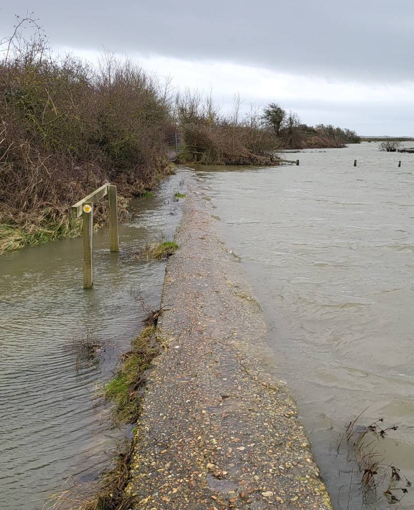
Wrapped up top to toe in waterproofs we set out along the sea wall… and in no time at all we came across a sign saying footpath closed! We wondered how closed it was, whether it was still passable, but looking ahead we could see there was a big gap where the sea had breached the wall…there was no alternative but to find another route. Our next attempt took us to this footpath… also closed as it was underwater (you can just make out the breached sea wall in the background). So we ended back on Southmoor Lane and made our way through the industrial estate.

We thought we’d found a way back to the coast walking on another bit of wall by the edge of the sea marsh. The sea water was lapping over the path and we paddled as far as we dared, but just when the gate was in sight, the water got a bit deeper and we thought better off it, retraced our steps and found our way through the houses.
Back on the A3023 where we picked up the path and saw this encouraging sign:

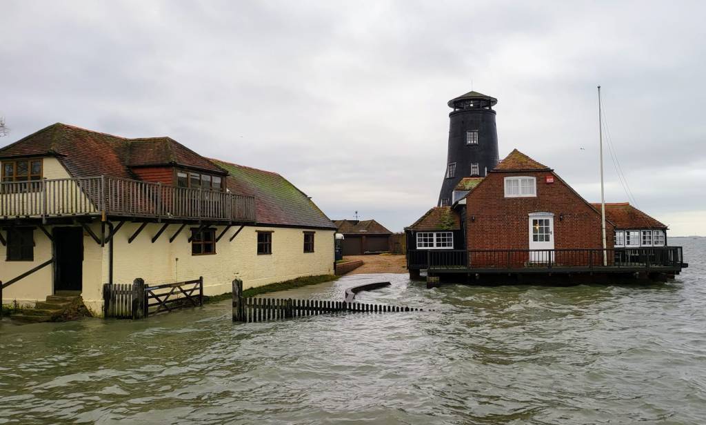
Langstone harbour was a pretty little place – although lots of properties had their floodbarriers on, so I guess it might be a challenging place to live. We resolved to go back on a nicer day to try out the pub which opens almost directly onto the sea! The old mill, now a private residence, was a working mill until WWI. Its distinctinve black colour is due to a tarred outer skin to protect it from the coastal weather. It was powered by both the tide and the wind and barges could be brought up to the mill for transporting the milled goods away around the coast
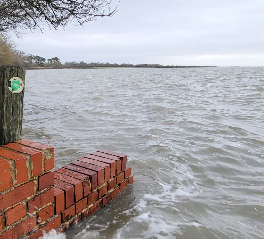
At Wade Court we encountered another path problem – the green arrow pointing the way was clearly visible… but unfortunately the path was under the sea! We did try to walk along the embankment, but didn’t get far before we had to turn back and go inland again.
The one benefit of this detour was that we saw the remains of Warblington Castle. This fortified residence was rebuilt by Margaret Pole around 1520, who was cousin to Henry VIII and was governess to Princess Mary (Bloody Mary). The house had a moat, staterooms, its own chapel, apartments and an armoury surrounding a great courtyard. Margaret was one of two women in sixteenth-century England to be a peeress in her own right with no titled husband. She and her sons refused to renounced the Roman Catholic Church and Henry had her executed and her sons exiled. After being held in the Tower of London for two and a half years, it is said that Margaret refused to kneel at the traitors block and the executioner had to chase her around the block taking swipes as he could and that it took seven swings to sever her head. The castle was dismantled during the English Civil War.

Back on the path again, the sea defenses around Emsworth were more robust and we were able to safely walk on them – although still glad of our waterproofs to protect us from the sea spray!… I made sure to be on the landward side of the path!!!
By this time we were very hungry and ready for a good meal in the Coal Exchange pub. It had a fire going and we soon warmed up tucking in to celebratory fish’n’chips and bangers’n’mash!
We attempted to find the official end of the walk, but were unsuccessful! Instead we headed back along the roads until a disused railway which is now part of the Ship Wrights Way. This took us back down to the A3023 from where we retraced our steps back to the car, arriving just as it was getting dark.
This (slightly unintenitional) route was a bit over 8 miles.
