Map of the route (8 miles): https://explore.osmaps.com/route/19782469/meon-1?lat=50.982153&lon=-1.045223&zoom=12.9309&style=Standard&type=2d
We parked our car in a car park on the corner of Workhouse Lane in East Meon. Rather disconcertingly google didn’t seem to know it existed, but we were relieved to discover it did exist in real life & was free of charge with plenty of spaces.
We set off heading out of the village to the south, following the road round past Garston Farm and turning into the woods at Duncoombe Cottage. As we walked up through the woods, we could look down to where our first ‘source’ of the Meon.
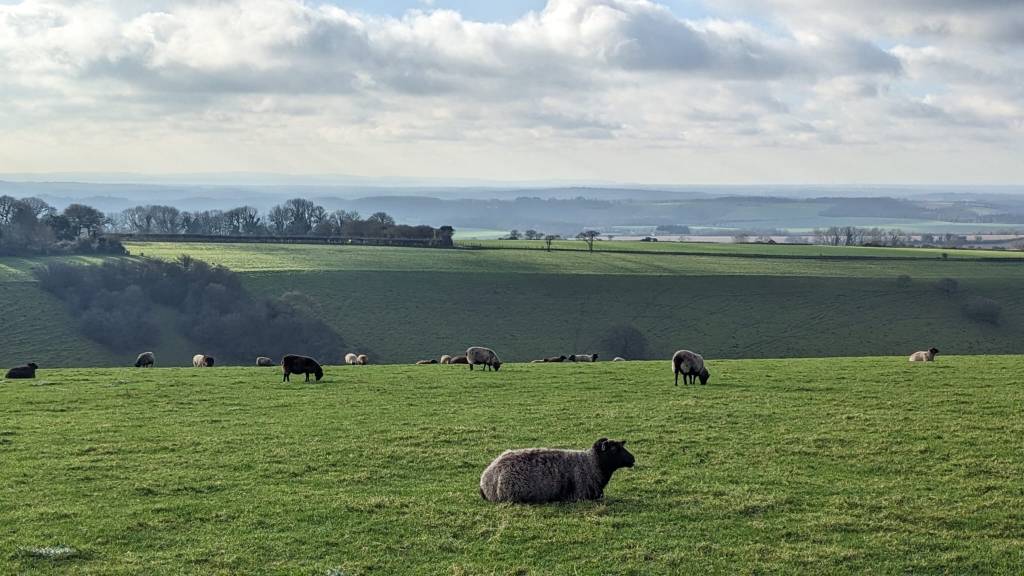
As we came out the woods we turned to walk up the steep hill onto Small Down, enjoying the wide views. On the top there are bronze age burial barrows which date back to around 2000BC. As we approached the reservoir and went to meet up with the South Downs path we looked in the direction and imagined we could spot it!!
As you look back towards East Meon you can see Vineyard Hole to its right (east). This steep escarpment was reputedly the site of a medieval vineyard. Wether Down is one of the highest hills in Hampshire. At the top is an aerial and also an enclosed reservoir. It is a good spot for hang-gliding and paragliding, but we were disappointed and didn’t see either. Somewhere on this ridge (before joining the South Downs Way) would have made a good spot for lunch, only it wasn’t yet lunchtime and we had a lot of walking ahead of us, so we pressed on.
We followed the South Downs Way to where it mets a road and turns left past the former site of Leydene House. This was built by Viscount and Lady Peel in the years following the Great War. Lord Peel was a politician and chairman of the Peel Commission which recommended the partitioning of Palestine. While Lord Peel spend most of his time in London, Lady Peel led a spartan countrylife – she liked to be outside always having her lunch of soup outdoors in all weathers, she dressed shabbily in long dark clothes and apparently preferred the company of her pedigree Saddleback pigs to that of people. The money for the grand house came from Lady Peel’s family. Her father was a multi-millionaire who had made his money from the manufacture of linoleum, so as an acknowledgement of this, the rose garden was laid in the design of his best-selling linoleum design!
In the Second World War, the house was occupied by the navy after its signal school in Portsmouth had been heavily bombed – it was called HMS Mercury. The land was sold in the 1950s, sub-divided into plots for housing, with the navy medical centre and mess converted into a Sustainability Centre. It was all very quiet on the day we passed.
We kept to the South Downs Way to Hyden Hill and then turned north. We stopped here for our lunch and it was quite a good spot, as with the hill behind us we were able to shelter from the wind. We were walking on a cold January day and before we could get warm again by walking, the path was in a bit of a wind-tunnel, making us unpleasantly cold.
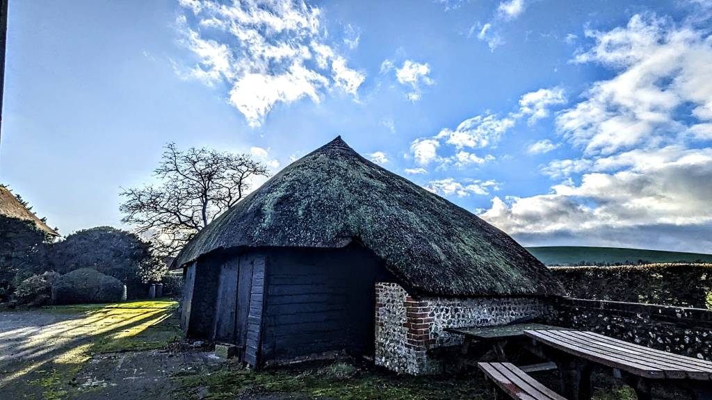
On our approach to South Farm we found another source of the River Meon… and also some Llamas! Shortly beyond this though we came to thatched buildings which reminded us it really was the English countryside we were in! By Parsonage Farm and Fishpond Cottages we found our third source of the Meon – definitely the prettiest!
We continued on the Cumber’s Lane byway to Greenway Copse and Frogmore. Frogmore is now an attractive place on the edge of East Meon with cottages by the river, but historically it was considered something of a slum with the hamlet housing mainly agricultural and mill workers.
The whole parish was a difficult place to live in the Second World War, with the Luftwaffe dropping 38 high explosive bombs and an estimated 3,500 incendiary bombs on the parish. However, the only loss of life from these attacks was a pig!
We made our way back into East Meon and were very pleased that the Izaak Walton pub was advertising tea and cake. We gladly partook to warm up!!
